 The Alabama Legislature established the Alabama Historical Commission (AHC) in 1966 to foster the understanding and preservation of Alabama’s heritage. In fulfilling its mission, the AHC has collected valuable information on Alabama’s man-made environment including historic houses, churches, schools, bridges, cemeteries, commercial buildings, farms, etc. These architectural survey files include paper survey forms; photographs (i.e. prints, contact sheets, slides and negatives); maps; measured drawings; blueprints; and accompanying materials.
While great strides have been made to maintain and organize these paper files, they have only been accessible by visiting the AHC’s main office. In addition, these files are unique and no back up existed for them.There is no way to replace a file if it is lost or damaged.
The AHC has been diligently working to convert paper files associated with Alabama’s historic architectural resources into a web-based system utilizing GIS technology to increase the information’s accessibility to the public and to ensure their long-term preservation.
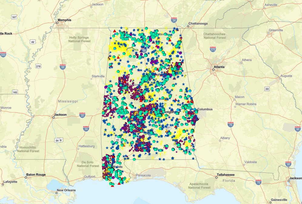
Easily accessible historic resource locations within a Geographic Information System (GIS) is an invaluable tool for those interested in Alabama’s built environment. The present project consists of digitizing and constructing a GIS database for AHC's Historic Preservation Division Programs. GIS is a framework for gathering, managing, and analyzing data that is rooted in the science of geography. The AHC now has available an ArcGis geo-database to display spatially the many thousands of historic resources across Alabama. Fifty-five counties have been plotted thus far: Autauga, Baldwin, Barbour, Bibb, Blount, Bullock, Butler, Calhoun, Chambers, Cherokee, Chilton, Choctaw, Clarke, Cleburne, Coffee, Colbert, Conecuh, Covington, Crenshaw, Dale, Dallas, DeKalb, Elmore, Escambia, Etowah, Fayette, Franklin, Geneva, Greene, Hale, Henry, Houston, Jackson, Jefferson, Lamar, Lawrence, Lee, Marion, Mobile, Monroe, Montgomery, Morgan, Pickens, Pike, Randolph, Russell, St. Clair, Sumter, Talladega, Tallapoosa, Tuscaloosa, Walker, Washington, Winston, and Wilcox.
The new Alabama Historical Commission Historic Preservation Map Initiative will enable the public to explore these resources virtually and understand why these resources are culturally important to Alabama, particularly in the communities in which they exist.
Our GIS map includes maps for all of the Alabama Historical Commission's many historic preservation programs. Listed below are the map layers included in the AHC’s online GIS map gallery.
Click HERE to begin exploring the interactive map.
Please note that most properties listed in the GIS Historic Preservation Map are located on private property (i.e., no public access). In these cases, please respect the landowner's property rights and privacy by viewing from the public right of way. To see a list of Alabama Historical Commission owned and managed properties with public access, visit ahc.alabama.gov/map